Global threats of a silent hazard: land subsidence due to groundwater extraction – Thursday 4 March 2021, 4 pm Athens (UTC+2)
Global threats of a silent hazard: land subsidence due to groundwater extraction
Gerardo Herrera1,2,3, Pablo Ezquerro1,4, Roberto Tomás2,5, Marta Béjar-Pizarro1, Juan López-Vinielles1,6, Mauro Rossi7, Rosa M. Mateos1,3, Dora Carreón-Freyre2,8, John Lambert2,9, Pietro Teatini2,10, Enrique Cabral-Cano2,11, Gilles Erkens2,12,13, Devin Galloway2,14, Wei-Chia Hung2,15, Najeebullah, Kakar2,16, Michelle Sneed2,14, Luigi Tosi2,17, Hanmei Wang2,18, Shujun Ye2,19
1Geohazards INSAR laboratory and Modelling group, Instituto Geológico y Minero de España, Madrid, Spain. 2Land Subsidence International Initiative (LASII), UNESCO, Paris, France. 3Geological Surveys of Europe, Brussels, Belgium. 4Escuela Técnica Superior de Ingenieros de Caminos, Canales y Puertos, Universidad Politécnica de Madrid, Madrid, Spain. 5Departamento de Ingeniería Civil, Universidad de Alicante, Alicante, Spain. 6HEMAV SL, Castelldefels, Barcelona, Spain. 7Istituto di Ricerca per la Protezione Idrogeologica, Perugia, Italy. 8Centro de Geociencias, Universidad Nacional Autónoma de México, Juriquilla, Mexico. 9Deltares, Delft, The Netherlands. 10Department of Civil, Environmental and Architectural Engineering, University of Padova, Padova, Italy. 11Departamento de Geomagnetismo y Exploración, Instituto de Geofísica, Universidad Nacional Autónoma de México, Mexico City, Mexico. 12Deltares, Utrecht, The Netherlands. 13Utrecht University, Utrecht, The Netherlands. 14United States Geological Survey, Sacramento, CA, USA. 15Department of Civil Engineering, National Chiao Tung University, Hsinchu, Taiwan. 16Department of Geology, University of Balochistan, Quetta, Pakistan. 17Institute of Marine Sciences, National Research Council, Venice, Italy. 18Shanghai Institute of Geological Survey, Shanghai, China. 19Department of Hydrosciences, School of Earth Sciences and Engineering, Nanjing University, Nanjing, China.
Abstract
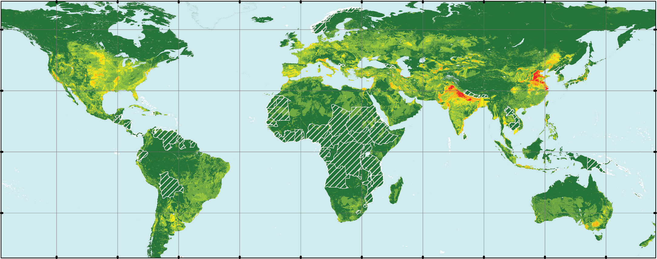
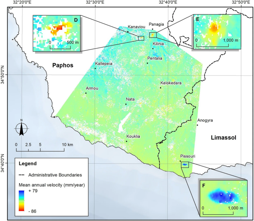
Groundwater demand owing to rapid urbanization and irrigation-agriculture land uses is increasingly depleting aquifers worldwide leading to prevalent aquifer-system compaction and land subsidence. Even if in the past century the land settlement of the Earth Surface impacted many urban and agricultural areas around the world, its global extension is poorly known. Remote sensing data, specially InSAR data, are one of the most important tools for subsidence detection, monitoring and analysis. InSAR mapping will help to interpret the possible triggering mechanism of detected surface displacements. We estimate that potential subsidence due to ground water extraction could extend for 2.2 million km2 of the land, threatening 1.2 billion inhabitants. This subsidence potentially increases the flooding risk of 484 million inhabitants living in fluvial and coastal flood prone areas. These findings are crucial to informing good governance practices aimed at ensuring the future sustainability of groundwater resources and reducing subsidence impacts worldwide, especially in coastal areas where the subsidence contributes significantly to relative sea-level rise. Moreover, the results of this work will promote the use of remote sensing data to study the high probability areas not analyzed, yet.
CV: Pablo Ezquerro Martín, Researcher from the Geohazards InSAR laboratory and Modelling Group of the Spanish geological survey geo-hazards department. Their work aims to combine radar satellite observations of Earth’s surface displacements, with geo-thematic layers, to advance the understanding of the mechanisms that control geo-hazards, quantifying hazards and evaluating the risk. Specifically, my research is focused on monitoring, analyzing, and modelling subsidence related to aquifer-systems changes.
Join Zoom Meeting
https://us02web.zoom.us/j/88484494224?pwd=V0FaOHk2MEQzN2UrMU12V1FMc3FMZz09

Meeting ID: 884 8449 4224
Passcode: 154623


